Localidad de Hochstadt (Pfalz) (Rheinland-Pfalz)
Informations
Cifras
- Código del país :
- DE
- Código postal :
- 76879
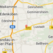
- Latitud :
- 49.24018
- Longitud :
- 8.21449
- Huso horario :
- Europe/Berlin
- Universal Time :
- UTC+1
- Horario de verano :
- Y
La localidad de Hochstadt (Pfalz) pertenece (de mayor a menor) al estado Rheinland-Pfalz, al condado Rheinhessen-Pfalz y al distrito Südliche Weinstraße.
©photo-libre.fr