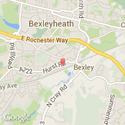
Ciudades próximas
- Bexleyheath ~2 km
- Barnehurst ~3 km
- Northumberland Heath ~4 km
- Sidcup ~3 km
- Crayford ~3 km
- Belvedere ~5 km
- Welling ~4 km
- Hextable ~4 km
- St Pauls Cray ~5 km
El transporte en Bexley
- Aeropuertos internacionales
-
City ~10 km
Gatwick ~40 km
Stansted ~50 km
- Otros medios de transporte
-
Biggin Hill ~14 km
North Weald ~31 km
London St Pancras ~21 km
St Pancras Railway Station ~21 km
London Euston Railway Station ~22 km