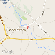
Localidad de Castledawson (Northern Ireland)
Informations
Cifras
- Código del país :
- GB
- Código postal :
- BT45
- Latitud :
- 54.77655
- Longitud :
- -6.55252
- Huso horario :
- Europe/London
- Universal Time :
- UTC
- Horario de verano :
- Y
La localidad de Castledawson pertenece (de mayor a menor) a la nación Northern Ireland y al condado Magherafelt.
©photo-libre.fr