Localidad de Knutsford (England)
Informations
Cifras
- Código del país :
- GB
- Código postal :
- WA16
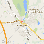
- Latitud :
- 53.30221
- Longitud :
- -2.37351
- Huso horario :
- Europe/London
- Universal Time :
- UTC
- Horario de verano :
- Y
Informations
Cifras
Ciudades próximas
El transporte en Knutsford
Informations
Cifras
Ciudades próximas
El transporte en Knutsford