Localidad de Wythenshawe (England)
Informations
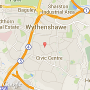
Cifras
- Código del país :
- GB
- Código postal :
- M22
- Latitud :
- 53.38372
- Longitud :
- -2.26459
- Huso horario :
- Europe/London
- Universal Time :
- UTC
- Horario de verano :
- Y
La localidad de Wythenshawe pertenece (de mayor a menor) a la nación England, al condado Greater Manchester y al distrito Manchester.
La localidad de Wythenshawe tiene 86.267 habitantes.
©photo-libre.fr