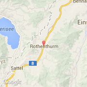
Localidad de Rothenthurm (Schwytz)
Informations
Cifras
- Código del país :
- CH
- Código postal :
- 6418
- Latitud :
- 47.10463
- Longitud :
- 8.67602
- Huso horario :
- Europe/Zurich
- Universal Time :
- UTC+1
- Horario de verano :
- Y
La localidad de Rothenthurm pertenece (de mayor a menor) al cantón Schwytz, al distrito Schwytz y al partido Rothenthurm.
La localidad de Rothenthurm cubre 22,80 km². La altitud mínima es de 878 m, la altitud máxima es de 1.540 m, la altitud media es de 1.108 m.
El idioma oficial de Rothenthurm es Idioma alemán. El nombre francés de la localidad es Rothenthurm, el nombre inglés de la localidad es Rothenthurm, el nombre español es Rothenthurm.
La página web de Rothenthurm es http://www.rothenthurm.ch
©photo-libre.fr